May
04
2014
Updated: Jan-15-2021, 10:54 AM

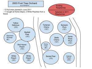
Thanks to Chris for suggesting i draw this in Google Drawings which exported the drawing above as a common SVG file 🙂
Update: Unfortunately, WordPress wouldn’t let me include an SVG image due to security reasons… huh?
2 comments on this topic
4. May - 11:59 pm
Nice! My next suggestion is that you use this on an overlay of google maps to show layout on top of the satellite photo!